Hiking in Utah
Adventures in Camping, Backpacking, Trail Running, and Canyoneering

Wild Horse Window
Goblin Valley, Utah

Contents

> Home
> About This Site


Overview

Trailhead and Map | Trail Description
Distance and Difficulty | Hiking Time | What to Bring

GPS Coordinates and Map

Wild Horse Window
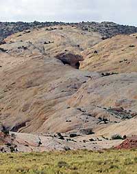
"So, there it is!" -- Wild Horse Window from the road over a mile away
Wild Horse Window is located in southcentral Utah, north of the small town of Hanksville off Highway 24. When you reach the Goblin Valley turnoff on Highway 24, head west on the paved road for about 5 miles, then turn left (south), and you will quickly see a dirt road within a few hundred feet on your right. Pull off and drive a short distance to the starting coordinates. You can start your hike at N 38.39.206, W 110.39.519. USGS Temple Mountain (UT) Topo Map. Click HERE to view the approximate starting coordinates and map.

I strongly suggest that before you start this hike, drive down a short distance south heading toward Goblin Valley and survey the Window from a distance N 38.38.598, W 110.39.699 so you can see your objective first.

Trail Description

South Temple Wash
"Down in the wash we go!" -- Entering South Temple Wash from the north at the start of the hike

If you're looking for a fun hike away from the main trails and fewer crowds, then this could be your adventure of choice in the Goblin Valley area.
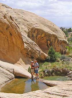
Jim and Diane on hike
"Ready for a swim?" -- Family, Jim and Diane, enjoying the scenery right near Wild Horse Window
In this description, the hike to Wild Horse Window, as it has been called, will first take you south along rocky and sandy wash for .25 of a mile. At N 38.39.026, W 110.39.689, you will leave the wash heading west, walk walk by a hiking pole marker at N 38.39.045, W 110.39.749, and then begin your hike up the slickrock at around N 38.39.042, W 110.40.046. You can plot these other waypoints to guide your way to your final destination, .83 miles from where you first left the wash. Since there is no trail, you are basically route finding the rest of the way:

N 38.39.077, W 110.40.215
N 38.39.131, W 110.40.435

The terrain will become sandy as an actual trail becomes evident and narrows, and the trail leads you into alcove area to where the Window is located. At certain times of the year, there will be a number of shallow plunge pools as you approach the area around N 38.39.161, W 110.40.539. If the pools are full of water, you might have to scramble down a short ledge or just splash through the water.

See Video - Windows Media Format (699 KB)

Window from a distance
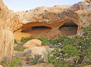
"Oh, a two-eyed monster!" -- Approaching the Window

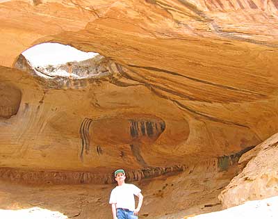
You will reach the windows at N 38.39.192, W 110.40.584 a short distance away. The right window or cave is home to the beautiful ceiling window. From the angle of the picture below, the inside wall almost looks home to an ancient petroglyph etched on the wall centuries ago.

Window
"Hey, is that a petroglyph of a bison on the wall?" -- A view of the Window, with author, from below

Distance and Difficulty

The route for this moderate hike just over a mile, with several hundred feet gain in elevation. Because there is no shade along the hike until the very end, the heat of the day could zap your energy. Children might enjoy this hike, but you might consider doing this in the morning or late evening during the summer months.

You can further explore this area up and around the Window, which might reveal some unique formations along the way.

Hiking Time

About 2-3 hours, depending on any stops along the way.

What to Bring

Plenty of water. A GPS will be helpful in marking the way.

Check Terms of Use.

Other Sites