 |
Adventures in Camping, Backpacking, Trail Running, and Canyoneering Pine Hollow & Mud Spring Trails |
> Home
|
Distance and Difficulty | Hiking Time | What to Bring
The trailhead starts at the Pine Hollow trailhead parking lot at N 40.27.000, W 111.38.635. USGS Timpanogos Cave (UT) Topo Map. Click HERE to view the approximate starting coordinates and map. View a complete trail map of American Fork Canyon HERE.
To reach your starting point, travel up Highway 92 for about 5 miles until you reach the Pine Hollow parking lot just after the switchback. There is a public restroom there, but no water is available. The trail starts across the street from the parking lot just before the gate on the left side. The first part of the trail slowly gains elevation as it enters into the forest, and you will reach a small open meadow and the crossroads of the Pine Hollow and Great Western trails (#151) at N 40.26.725, W 111.37.637, about a mile from your starting point. Turn left and follow the Great Western Trail another half mile until you reach a larger meadow. This could be a nice spot to pitch a tent for a short in-and-out backpacking trip.
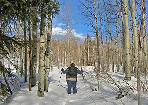
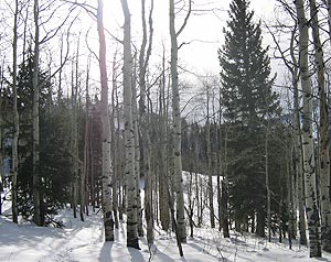
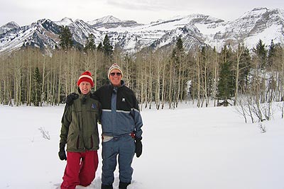
If your destination is Mud Springs, then turn left on to the Ridge trail heading north, which will, in a matter of a couple of minutes (.25 of a mile), place you on top of a ridge at N 40.26.882, W 111.37.072, where you can look down into Heber Valley to the east. On this particular wintery day in January, the trail from the parking lot to this point had been well used by snowshoers and other hikers, so it was easy going to this point. In fact, having never done this hike before, it would have been more difficult to determine the route with out some footprints to follow. However, from the ridge on, only one solitary snowshoer paved the way toward Mud Springs. Of course, this is more of a summer hike, so you might expect more foot traffic during that time of year.
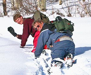
See Video - Windows Media Format (958 KB) The solitary snowshoer we had been following took the Ridge Trail, so from this point on, we were simply punching holes into the 2 to 3 feet of snow we encountered along the way. In terms of the trail, although it was completely shrouded in snow, we could still detect a slight sinking depression along the route, a sure sign that we were following in its path. It was a very peaceful, but somewhat grueling trek that could have been easier had we pack snowshoes. My companions led almost the entire way, and at some points, crawled on hands and knees so they wouldn't sink to deeply in the powdery snow. Being a foot taller than I am might have helped them for I surely was tired trudging through snow half my height.
In spite of these obstacles, I could only imagine the peaceful serenity of the journey in summertime, realizing that if you wanted to get away from the hordes of hikers along the Timpanogos trail or others like it, this route would give you the respite you might be looking for. Our actual final destination on this hike was to reach a geocache (hidden treasure box) on the north end of the meadow, which we found easily. We had a quick lunch, and then made the return trip following the same path followed earlier. Summary: This was a fun, but challenging winter hike, that I would certainly do again. The great views of Timpanogos from this viewpoint were well worth the adventure, and I can only imagine that a hike in the summer would be just as pleasant. Because even many locals aren't very aware of these trails, you are sure to encounter fewer people on this hike than shorter ones around Tibble Fork to the north, or the popular Timpanogos trail to south.
It is a moderate to strenuous 3.2 mile hike one way which can be accomplished year round depending on weather conditions and the accumulation of snow on ground. I would certainly take snowshoes which would be needed higher up the trail.
Well, we did this during the deep of winter, and it took us 4 hours in and about 2 hours out. A summer hike would certainly shorten the time considerably.
First, good hiking companions like I had will make all the difference, especially when it is a hard hike. Good hiking shoes and the usual safety gear for this type of hike are also a must. I am assuming that you could get water from Mud Springs along the way, but since we did this in the winter with several feet of snow on the ground, I can't comment on this definitively. I will have add an appendage to this page after I do the route in the summer.
|
| Other Sites |