 |
Adventures in Camping, Backpacking, Trail Running, and Canyoneering Squaw Peak 50 Mile Trail Run - Snow Course |
> Home
|
Cut-Off Times | Race Description
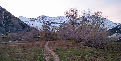
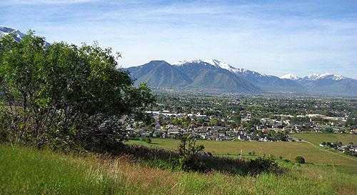
The official Web site for the race (Squaw Peak 50 Mile Trail Run) describes the event in detail and directions on how to get to the area. (The starting point is shown below.)
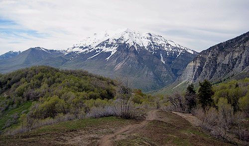
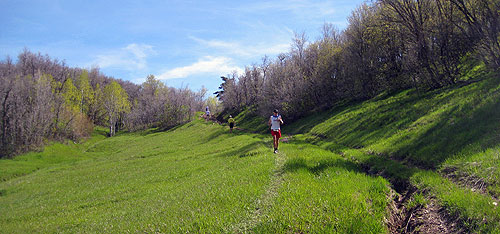
The very challenging 50-mile race consists of trail, dirt road, and a snippet of paved trail for the first 2 miles, with a number of major climbs. There are 10 aid stations with a total elevation gain of over 10,000 feet. The undulating section of the Bonneville Shoreline Trail above Provo and Springville are deceptive in that simply looking at a map could lull you into thinking this section is easier than it really is. With a number of places that a person could drop in this year's version (rather than in the normal course when you find yourself on your own for miles after mile 33), the course was somewhat more mentally taxing.
This being the first year of the course, the soft cut off for the race was 6:00 p.m. at aid station 9 at the Rock Canyon Trailhead (mile 38).
For a couple of months leading up to the race, I was really wondering how the race would be held, seeing the huge amount of snow that was being dumped in the mountains. This thought continued to grow until it was announced about two weeks before that an alternative route was being finalized that would still allow the race to go forth. Thus, instead of winding up the left fork of Hobble Creek, by Little Valley, and up and over Windy Pass, the route would still start at Vivian Park, but would pass through Rock Canyon Campground, down Rock Canyon to the trailhead in the foothills or Provo, and first travel eight miles south toward Springville on the Bonneville Shoreline Trail.
Personally, I thought it would be fun to try a new route even though the normal course is much more scenic. It is always fun to try a new course, particularly one that might not be used again, or at least, not for years . . . . and yet again, it could be brought to life if we have another big snow year. Having not done this route before, I had fuzzy expectations on what to shoot for, but I plotted out some tentative time goals for reaching each aid station, with the target of finishing around 14:45. This was taking into account the time I often spend doing my video documentary of the race. I took the day off before the race to relax, cut the grass (if you can call that relaxing), and prepared my basic gear. I also attended the pre-race dinner to gather additional insight and information on the course. That evening, I got to bed at about 11:30 . . . I never sleep well before a race.
I arrived at Vivian Park around 3:30 a.m. having received permission from John, the race director, to do so to start early at 4:00 a.m. in order to get some video of the lead runners near the beginning of the race. I would have qualified for the early start because of my last year's time (15:40). I prepared two drop bags, one for aid station #4 (which also functioned as aid station #8), and the turnaround point at mile 25. Over time, I have used little from such drop bags, but I usually put in a few items that I might not be able to get aid stations.
The air was quick brisk, so I worn some gloves and a long shirt, and after a brief countdown by John, the 20 or so runners were off into the dark. The first couple of miles were uneventful, but I felt somewhat . . . well . . . blah if I could describe it that way. Not bad, but I didn't seem to have a lot of energy, which isn't a good sign for a long race. After a mile or so, I settled behind the woman in the lead as we started climbing the Bonneville Shoreline Trail, and after a half mile or so, I passed the woman and pressed on until I tripped on a rock, bit it hard, and did an awkward tumble on the ground. Ouch. I got back up, and then soon there after, started the climb up to the first aid station at mile 5.5 at Hope Campground. Once again, a breakfast of sausages and pancakes was being prepared by the volunteers; personally, I wouldn't mind a filling meal at about mile 15 or 35. I'm just not very hungry one hour into a long race.
I pressed on for the next 1.5 miles until I reached the high point of the course. Still no sign of other runners behind me. After recording some video, I then started downhill, crossed Squaw Peak Road, and proceeded down through the meadow until I spotted in the distance a group of what I initially thought were hikers. As I approached, I saw that the four were wearing bib numbers and one of them was injured. As it turned out, one of them (Craig Manscill) had fallen and had broken his leg above the ankle while they were marking the course for this race ahead of the runners. After the fall, they were simply trying to work their way up to the road to seek help. I loaned them my cell phone, but there weren't able to reach someone to report the injury. Thus, the runner's three companions proceeded to help him up to the road to a point where help could be secured. Fortunately, the accident was reported at the next aid station. After the race was over, I heard that the runner needed to have a plate and 8 screws put in his leg. Wow. Being in a group does pay off in case something unfortunate happens. After passing through the meadow, I headed down Squaw Peak Road for about a mile, crossed over an avalanche that had completely covered the road, and turned right into Rock Canyon Campground. At that point, I still didn't see anyone behind me, so I pushed on with the goal of reaching the bottom of the canyon and aid station #3 at around 6:45 a.m. After almost two miles of running down the canyon and with a short distance to go, I noticed another early starter behind me, and we arrived at the same time at the aid station.
The aid station volunteers appeared not to have heard about the injured runner at that point, but this information was relayed to them. I grabbed a few things at the aid station and took off, heading south along the Bonneville Shoreline Trail toward Springville. It wasn't until after a couple of miles that the elite runners started catching up and passing me by aid station #4 at around mile 15.45. What made the entire 8-mile section of the Bonneville Shoreline difficult is that there are so many climbs and drops; it wasn't an eternally-flat section that many were probably hoping for on race day. Discouraging to say the least. I kept pushing as much as I could in order to arrive before 9:30 a.m. at the Spring Creek aid station at about mile 20. Fortunately, I arrived at 9:02, almost 30 minutes ahead of schedule, but I would need all of this time to give me a buffer.
Once I started climbing Spring Creek Canyon, I knew that the day wasn't going to get any easier. The sun was breaking over the mountains, and temperatures were rising slowly. For the next couple of miles, it was slow going, particularly because of all the loose rock on the trail. I saw some familiar faces including Jim Bawden. As I approached the top, the lead runners were coming down quickly, and it was good to get a sense of where you were among the runners. Once I made to around mile 22+, it was downhill from there. The runners coming up were several miles (and at least an hour) ahead of me, and I jokingly asked one runner if he wanted to switch numbers with me. No go. About a mile from the turnaround point, you cross a open meadow, where on many days, cows on roaming the area. I've run through here in the dark, and although cows try to avoid you, they can still give you a fright if you mistake one for a mountain lion, black bear, or even a wild turkey. At the Pole Haven aid station (mile 25), I had my second drop bag waiting with some cold chocolate milk that always is a freshing change from water or a sports drink. After a minute or two, I began the slow climb out of Hobble Creek. At least I could see the runners behind me. Once at the top and as I started my descent, I ran into some friends from St. George, Jeremy and Adriane, and we chatted for few moments before we continued on in our own directions. The downhill was slow because of the terrain, and I came across more runners coming up, and just as I kept thinking to myself, "Oh, this must be the last runner," more runners followed. "Now, this has to be the last runner." Nope. Then, I saw Grant Holdaway (80 years old) looking good and hiking with family on the way. However, it wasn't unntil after I was beyond the Spring Creek aid station that I came across the last runner. Yet, in spite of the time, people were finding a pace that worked for them, and completing such a difficult race, at whatever time you finished, should be considered a real accomplishment. Just think of the 2+ million people in the state that were doing something else on that day. I've been dead last in a race (the winners had long gone home and everything around the starting area was being torn down), but the idea of doing something mentally and physically difficult is its own reward. The next 8 miles along the Bonneville Shoreline Trail were uneventful . . . simply just hot. Around mile 36, Carl Tippets came strolling by me. We have been in several of the same races over the last year, including the Antelope Island 100K and the Buffalo Run 50 Mile, and just like clockwork, he always passes me with a friendly smile at this point in the race. Yet, I very much appreciate the comraderie and mutual support that comes with trail racing, even if you find yourself at the back of the pack. I arrived at the Rock Canyon aid station at 2:38 p.m., just 10 minutes behind schedule. I knew the next climb over three miles wasn't going to be pleasant, so I paused a couple of minutes, enjoyed some melon, a cookie, and some drink, and then I slowly made my way up the canyon. Slowly. The next two miles felt like a death march. Well, not exactly, but it was slow. Several groups of hikers coming down asked me why the people with numbers were going up the canyon; after explaining it four separate times on the way up, I was never able to get any takers to switch places for the last eight miles of the race. "Hey, there are only eight miles left. Come on! How hard can it get?"
As I approached the top of the canyon near Rock Canyon Campground, Jim Bawden had caught up with me. He said he was feeling a little queezy, and at Squaw Peak Road, decided to sit down and try to get down a gel for some energy. I continued up the road until I had to cross the snow section covering the road. Let me tell you. The shoes I was wearing, the Hoka One One, might be fine on trail, but they never work for me on snow. So, I did an unstylish fall on the snow pile, and the two runners behind me, Angela Hanks and Gina Ovard, just wouldn't, for some reason, replicate my fall. The next half mile was again slow all the way to the high point of the course. I was feeling a hotspot on my foot, so I sat down on a rock to check my foot. A minor blister, but rather than worrying to much about it at that moment, I decided to make my way down the trail to the final aid station at Hope Campground (mile 44.8). Right before I got there, here comes Mike Hunter bouncing down the mountain, full of vigor. We had met the night before at the dinner, and this was to be his first ultramarathon, and he was certainly looking good. "Man, where did you pick up your new batteries?", I thought. As usually, I stopped at the final aid station and had some melon and a cookie, had my bottle filled with lots of ice and water, and then walked out of the aid station. A couple of miles back, I had somehow mistakenly concluded that I was off pace to make it under 15 hours, but after doing some calculating in my mind, I thought it could be possible if I picked up the pace once I hit the Bonneville Shoreline Trail with four miles to go. At that point, it was a little after 6:00 p.m. Okay, that means that I have to average at least a 14 minute mile or so to make it. Not usually a problem if you haven't already traversed 46 miles on mountain trails. I picked up the pace and was surprised to look at my watch in that I averaged about 9:30 mile over the next two miles down the mountain on the rocky and root-infested Bonneville Shoreline Trail, and these were some of the best and most "comfortable" miles for the entire day. Once I hit the pavement, I realized that I simply need to run, walk, and shuffle to the finish line, but even though I would probably still make it under 15 hours, the finish line just didn't seem like it was coming quick enough, so I decided to push it a little during the final half mile. Fortunately, I made it across at 14:51. After eating the post-race meal of pasta, chicken, salad, and a roll, couple with some refreshing chocolate milk, I called it a day.
|
| Other Sites |